Astronaut Captures Predawn Lights Over the U.S. Heartland
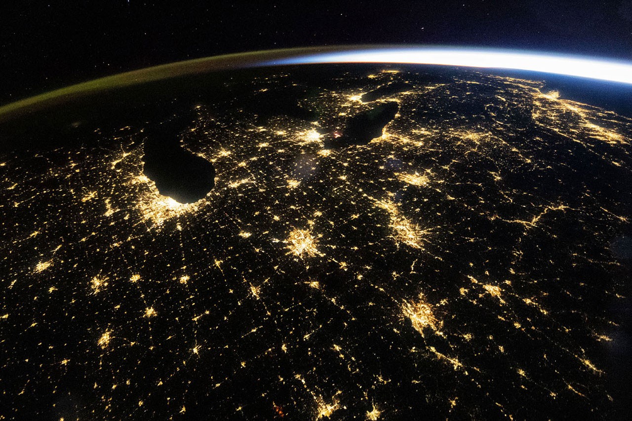
A predawn shot from the International Space Station on Oct. 18, 2026 reveals bright city lights, sunrise glow and atmospheric airglow across the eastern United States.
Clear Predawn Skies Over the Eastern United States
On October 18, 2026, clear skies covered much of the eastern United States during the predawn hours. An astronaut aboard the International Space Station captured a wide‑angle photograph at 4:54 a.m. Central Daylight Time (09:54 Universal Time). The image shows illuminated cities of all sizes spread across the darkened terrain.
Bright Urban Centers and Highway Networks
The photograph highlights the Midwest’s largest metropolitan areas, with Chicago, Illinois and Detroit, Michigan standing out as some of the brightest features. Mid‑sized cities—including Indianapolis, Indiana; Cincinnati, Ohio; and Louisville, Kentucky—and the web of state and interstate highways linking them also shine prominently.
Atmospheric Airglow and Sunrise Horizon
Above the network of nighttime lights, a diffuse band of green and orange appears along the left horizon. This glow is identified as airglow, produced when sunlight excites atoms and molecules in the upper atmosphere, causing them to emit photons. To the right, the Sun’s light arcs across the horizon; sunrise was about an hour away on the East Coast and roughly two hours away in Chicago.
Scientific Value of Nighttime Light Images
Photographs taken from the ISS and other remote‑sensing platforms are valuable for tracking changes in the built environment. In the wide view, Chicago’s lightscape appears as a homogeneous pale yellow, but detailed images reveal a range of colors from different lighting types. Using NASA’s Gateway to Astronaut Photography of Earth archive, researchers have devised a method to differentiate lighting types within individual pixels of nighttime photos. Quantifying urban lights’ brightness, color and extent helps scientists understand how cities expand and evolve.
Satellite Observations Complement Astronaut Photos
Since March 1, 2024, satellite sensors have also monitored nighttime lighting. NASA’s Black Marble product suite provides science‑quality records of nighttime lights at daily, monthly and yearly scales. In the eastern U.S., these data have been used to track power outages after major storms, lighting changes from new infrastructure, and the shift from older lighting to LED technology.
Technical Details of the Images
The predawn image (ISS075‑E‑226709) was captured with a Nikon Z9 digital camera using a 14 mm focal length. A second image (ISS070‑E‑105097) taken on March 1, 2024 employed a Nikon D5 digital camera with a 400 mm focal length. Both photos were taken by members of the Expedition 75 and Expedition 70 crews, respectively. The images have been cropped, contrast‑enhanced and cleared of lens artifacts.
NASA’s Commitment to Open Earth Observation
The International Space Station Program supports the laboratory as part of the ISS National Lab, enabling astronauts to capture Earth images that are valuable to scientists and the public. All images are freely available online through the NASA/JSC Gateway to Astronaut Photography of Earth. Additional astronaut and cosmonaut photographs can be accessed there.
Story by Lindsey Doermann.