NASA Satellite Images Reveal Snow‑Free “Skull” on Vega Island as Antarctic Glaciers Thin
NASA’s Landsat 9 photos show Vega Island’s icy “skull” losing its snow coat, highlighting accelerating melt across the region.
Vega Island’s eerie silhouette
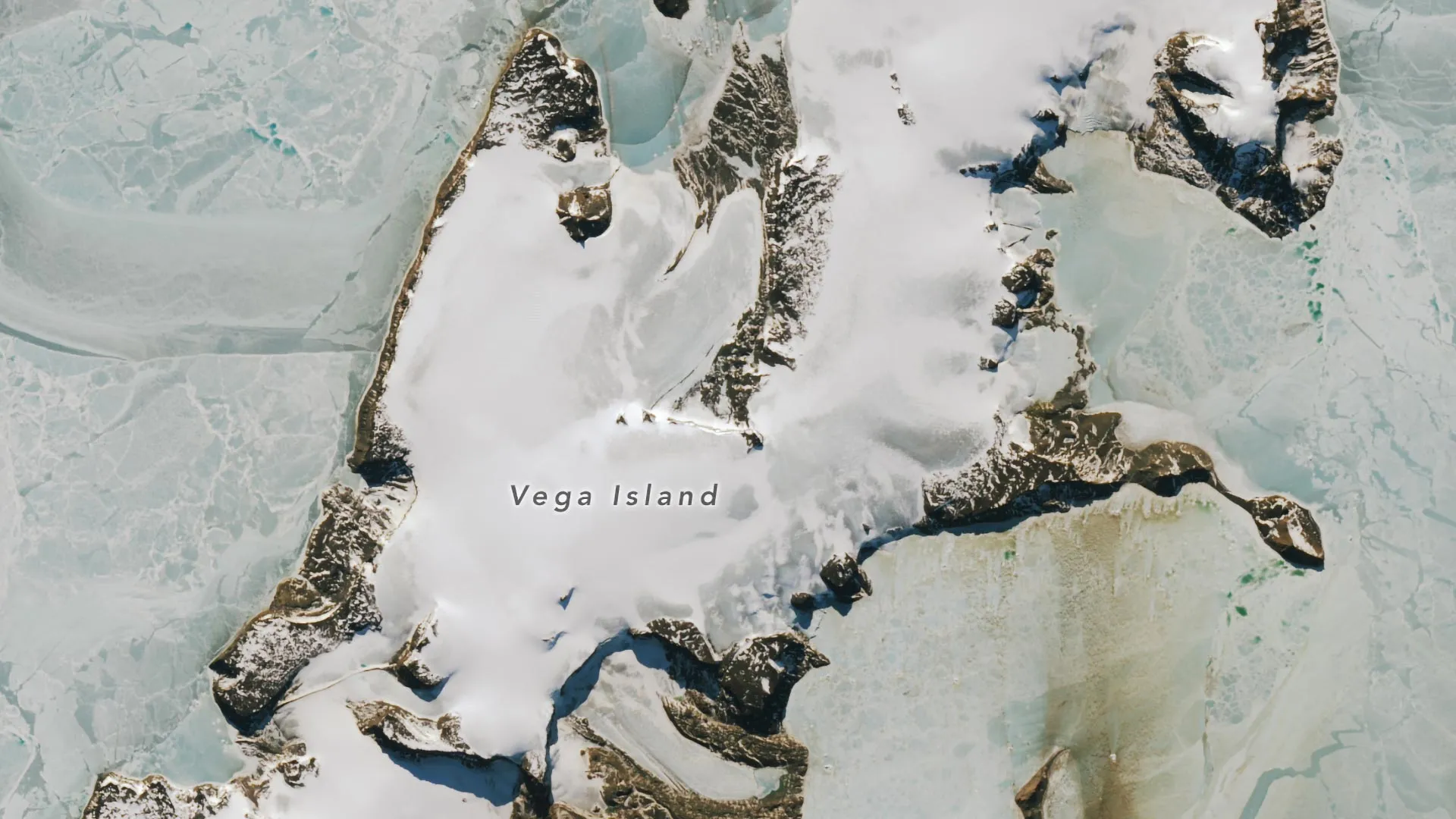
From the air, Vega Island in the Weddell Sea, east of the Antarctic Peninsula, looks like a skull turned toward Devil Island. A nunatak forms an empty eye socket, a lateral moraine outlines the mouth, and the Bahía del Diablo (Devil’s Bay) Glacier creates a lower jaw.
Satellite snapshots of change
NASA’s Operational Land Imager on Landsat 9 recorded the island on 22 March 2025 and 10 October 2026. The March image shows the terrain blanketed in snow, matching the region’s wettest month. By October, large areas were snow‑free, revealing darker glacier ice. Clouds obscured the island in March 2026, so that date is not shown.
Why the snow vanished
Glaciologist Mauri Pelto of Nichols College says the winter of 2026, especially June, was unusually warm. The warmth, combined with sublimation—ice turning directly into water vapor—and strong winds that swept snow away, left little fresh snow on Vega Island and nearby islands.
Antarctic glaciers are losing snow cover, accelerating melt.
Implications of exposed ice
Snow reflects most sunlight, while exposed ice absorbs more energy. As daylight lengthens and temperatures rise, the darker surfaces are likely to warm faster, potentially speeding up glacier melt. Pelto notes that even a thin layer of new snow from a spring storm could temporarily slow this process.
Future of the “skull”
Continued melting may reshape Vega Island’s distinctive features. Pelto explains that when the ice and snow disappear, the “skull” will weather away, altering the jawline and expanding the eye socket.
Decades of observation
Scientists have monitored Vega Island’s glaciers for years. A 1982 study using early Landsat data, aerial photos and topographic maps identified four ice caps, rocky cliffs and 29 glaciers. Devil’s Bay Glacier, tracked since the 1998‑1999 Antarctic summer, has shown a net loss of mass. Recent satellite records confirm that other glaciers on the island are also shedding ice and revealing more bedrock.
Vega Island’s haunting visage serves as a visual reminder that Antarctica’s frozen landscapes are rapidly changing.